


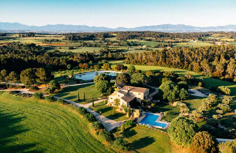
The Iberian Peninsula covers enough geographic variety to sustain a dedicated outdoor itinerary without repeating a landscape or an activity type. Granite mountain ranges, Atlantic surf coastline, volcanic Mediterranean islands, river gorges, and semi-arid interior plateau sit within a few hours of each other by road or rail, and the infrastructure for outdoor pursuits across Spain and Portugal has developed significantly over the past two decades. This article moves through the peninsula’s main adventure zones, covering what each offers and how to connect them.
Madrid as a Base and the Rail Corridor South
Madrid sits at the geographical centre of the Iberian Peninsula at 667 metres above sea level – the highest capital city in the European Union – and its position makes it a practical hub for reaching the outdoor zones of both Spain and Portugal. The Sierra de Guadarrama directly north of the city, now a national park, provides hiking, mountain biking, and in winter cross-country skiing within ninety minutes of the city centre by regional train from Atocha or Chamartín stations. The train from Madrid to Barcelona on the AVE high-speed service takes two hours thirty on the direct connection, and the Catalan capital opens access to the Pyrenees to the north and the Costa Brava sea kayaking routes to the northeast – a corridor that covers mountain and coastal adventure in a single base change. The Monfrague National Park in Extremadura, three hours southwest of Madrid, is one of the best raptors sites in Europe – black vultures, Spanish imperial eagles, black storks, and griffon vultures all breed in the cork oak and Mediterranean scrub landscape of the Tagus river valley – and the walking trails along the river gorge are as rewarding for non-birders as for the dedicated ornithologists who travel specifically for the species list.
The Pyrenees – Spain’s Northern Wall
Stay ahead of the geopolitical week.
MD Briefing delivers expert analysis across five global fronts — the Indo-Pacific, energy, geoeconomics, European security, and the Middle East — every Monday morning. Free.
The Pyrenees form a near-continuous mountain barrier along Spain’s northern border with France, running 430 kilometres from the Atlantic coast of the Basque Country to the Mediterranean shore of Catalonia, and the Spanish side of the range contains some of the most varied and least crowded high-altitude terrain in western Europe. The Ordesa y Monte Perdido National Park in Aragon is the centrepiece – a series of deep glacial canyons cutting into a limestone plateau that reaches 3,355 metres at Monte Perdido, the third highest peak in the Pyrenees. The Faja de Pelay trail traversing the northern wall of the Ordesa canyon at around 1,900 metres is one of the more technically straightforward high-altitude walks in Spain with views down into the canyon floor that establish scale in the most direct way available. The Aigüestortes i Estany de Sant Maurici National Park in Catalonia covers the wettest section of the Spanish Pyrenees, where snowmelt feeds over two hundred lakes connected by streams and traversed by a network of mountain huts that makes multi-day trekking circuits self-sufficient. The Basque Pyrenees in the west are lower and greener than the central range, with walking trails that pass through working farms and villages where the path doubles as a farm track, giving the walking a human dimension the higher peaks lack. Skiing in the Pyrenees runs from late November through April in the major resorts of Baqueira-Beret in the Val d’Aran and Formigal in Aragon, with snow reliability that has diminished over the past two decades but remains adequate in the upper elevations.
Portugal’s Atlantic Coast and the Surf Corridor
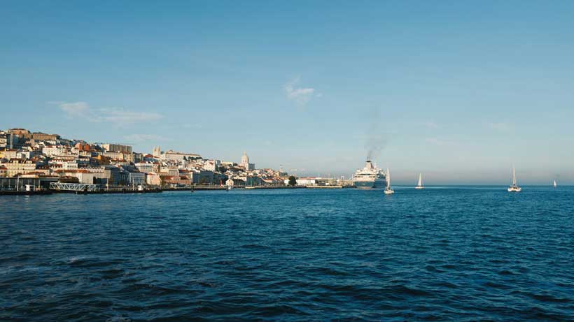
Portugal’s west coast faces the full fetch of the North Atlantic and produces wave conditions that have made the country one of the defining surf destinations in the world over the past two decades. Nazaré on the Silver Coast became globally known in 2011 when Garrett McNamara surfed a wave measured at 23.77 metres – at the time the largest wave ever surfed – and the Praia do Norte below the town continues to produce extreme big wave conditions between October and March when the underwater canyon channels Atlantic swells into the bay with a focusing effect that amplifies height. For surfers at more accessible levels, the beaches between Ericeira and Peniche form a stretch of consistent reef and beach breaks that has earned Ericeira designation as only the second World Surfing Reserve in Europe after the Basque Country’s Mundaka. The Porto to Lisbon train on the Alfa Pendular service takes under three hours and runs close enough to the coast through the Silver Coast region to give a clear sense of the surf geography before you arrive – the line passes Nazaré, Caldas da Rainha, and the Óbidos lagoon in quick succession through the window. The Alentejo coast south of Setúbal, protected within the Vicentina Coast Natural Park, has the least developed Atlantic shoreline in western Europe – long empty beaches, coastal walking trails, and consistent wind that makes the area one of the better kitesurf locations on the peninsula.
The Serra da Estrela and Portugal’s Mountain Interior
Portugal’s highest mountain range on the mainland offers a winter sports and summer trekking combination that most visitors focused on the coast entirely miss. The ski area at Torre, the highest point in Portugal at 1,993 metres, is small by alpine standards with around a dozen runs, but the surrounding plateau landscape – granite boulders, glacial valleys, and high-altitude bog – provides winter walking and snowshoeing terrain that operates independently of the ski infrastructure. The Ice Road hiking route in summer traverses the glacial valley of the Zêzere river through terrain shaped by the last ice age with a directness that the geology makes physically readable – the U-shaped valley profile, the polished rock surfaces, and the deposits of glacial debris scattered across the valley floor are textbook glacial geomorphology visible without a textbook. The village of Piódão in the foothills of the Serra da Estrela, built entirely from the local schist stone in a shade of dark grey that blends the buildings into the hillside, sits at the end of a winding mountain road and produces the kind of encounter with vernacular architecture that the more-visited hill villages of Tuscany and Andalusia have lost to commercialisation. The Douro Valley further north, carved by the river into terraced vineyards on steep schist slopes, offers hiking trails along the river and through the quintas that combine serious physical challenge with the option of tasting port wine at the end of it, which is an unusually satisfying combination.
Southern Spain – Sierra Nevada, Andalusian Trails and the Coast
The Sierra Nevada in Granada province contains the highest peaks on the Iberian Peninsula – Mulhacén at 3,479 metres and Veleta at 3,392 metres – and the ski resort of Sierra Nevada is the southernmost in Europe, operating reliably through March and occasionally into April. The high trails above the ski area in summer connect the main summits through terrain that transitions from Alpine meadow to high-altitude rock desert within a few vertical kilometres, and the view from Mulhacén on a clear day takes in the Mediterranean coast, the Rif mountains of Morocco, and the Baetic Cordillera stretching west toward Cádiz. The Caminito del Rey in Málaga province, a boardwalk fixed to the vertical walls of the Guadalhorce river gorge originally built for workers maintaining the hydroelectric infrastructure, reopened in 2015 after extensive restoration and now provides a via ferrata experience accessible to walkers without climbing experience – the seven-kilometre route takes around three hours and the overhanging sections above the gorge produce a reliable adrenaline response regardless of how rational you feel about heights in ordinary circumstances.
Catalonia and the Mediterranean Coast
Catalonia’s outdoor offer extends from the high Pyrenees in the north to the Cap de Creus headland where the mountains finally reach the Mediterranean, and the variety compressed into that north-south corridor is more than most regions manage across a larger area. The Costa Brava between Blanes and the French border has sea kayaking routes along a coastline of limestone headlands, hidden coves, and clear water that supports significant marine life including grouper, octopus, and posidonia seagrass meadows visible from the surface. The Montserrat massif an hour west of Barcelona is a conglomerate rock formation of extraordinary shape – serrated vertical columns rising to 1,236 metres – with via ferrata routes of varying difficulty fixed into the rock face and multi-pitch climbing on walls that have been developing as a climbing destination since the 1930s. The Ebro Delta on the southern coast of Catalonia is a flat wetland of rice paddies, lagoons, and sandbars that produces some of the best flamingo, tern, and duck watching in Spain alongside kitesurfing conditions generated by the consistent tramontane wind off the Mediterranean. Lleida province in the interior Catalan pre-Pyrenees has white water kayaking on the Noguera Pallaresa river, where the spring snowmelt produces grade three to five rapids through a canyon that hosts the Spanish kayaking championships annually.
Conclusion
Iberia’s outdoor offer covers enough terrain, climate, and activity type to structure an entire year of adventure travel without leaving the peninsula. The rail network between Madrid, Barcelona, Porto, and Lisbon connects the main adventure zones efficiently enough that a car is unnecessary for the intercity sections, even if local exploration within each region benefits from one. Start with the terrain that matches the season – Pyrenees in summer and winter, Atlantic surf coast in autumn and winter, Sierra Nevada in spring and early summer, Douro Valley in September – and build the itinerary outward from there.
